 Every Lake
A bathymetric map is a map of the underwater shape of a body of water. Where an ordinary map shows hills and valleys on land, a bathymetric lake map shows the lake bed: where the bottom shelves gently away from the beach, where it drops off, and where the deepest hole sits. The word comes from the Greek for "deep" and "measure," and it is the underwater cousin of a topographic map.
Most lake depth maps are drawn with contour lines. Each line connects points of equal depth, so every line is a level of the lake, much as a trail map's lines are levels of a hill. Read the lines and you can see the whole bowl without getting wet. The rest of this guide covers how those lines get onto the page, how to read them, and why the shape under the surface explains so much about a lake you already know from the top.
Contour lines: the idea behind every depth map
Imagine draining a lake one foot at a time and tracing the new shoreline at each stop. The first trace is the shore itself, at zero. The next follows the line where the water would be one foot deep, then ten feet, and so on. Stack those traces and you have the lake bed. That is all a contour map is: a set of shorelines for imaginary water levels.
The spacing between lines carries the information. Lines packed close together mean the bottom falls away quickly, a steep drop-off. Lines far apart mean a flat, gentle bottom. A closed loop in the middle of the lake is either a hole or a hump, and the depth numbers tell you which. Mapmakers choose a contour interval, the depth step between lines, to suit the lake. A small, shallow lake may use a few feet between lines, while a deep mountain lake needs far larger steps or the map would be unreadable.
How the depths are measured
Lead lines and soundings
For most of history, depth meant a weight on a rope. A surveyor in a rowboat lowered a lead weight until it touched bottom, read the knots or marks on the line, and wrote the number down. Each reading is a sounding. The method was slow, and a lake was mapped one spot at a time, so a surveyor might take a few hundred readings and draw the rest by judgment between them.
Echo sounders and sonar
In the twentieth century, boats began carrying echo sounders. A transducer on the hull sends a pulse of sound down, times the echo from the bottom, and converts that time into depth using the speed of sound in water. A boat can take readings every second while it runs lines back and forth across the lake. Modern multibeam sonar fans out many beams at once and sweeps a wide strip of bottom in a single pass. Where a lake is shallow and clear, airborne lidar can sometimes see the bottom from above.
The scale of modern surveys can be huge. Lake Tahoe, with a maximum depth of 1634 ft from soundings, has been mapped from some sixty million of them. That is a long way from a man with a rope.
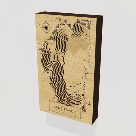 Lake TahoeCA · NV · 3D wood depth map · from $149
From soundings to a surface: how models fill the gaps
Even sixty million soundings are still points. A depth map needs a continuous surface, so the points are fed into software that interpolates between them, estimating the depth at places nobody measured. Boat tracks are never perfectly even. Surveyors run parallel lines some distance apart, and the space between lines is filled by calculation.
This is the difference between a measured map and a modeled one. A lake mapped with dense sonar is mostly measurement, and the contours follow real features. A lake with only a handful of old soundings is mostly model: smooth, plausible lines that can miss a hole or a sunken bar. Neither is wrong, but they carry different confidence. Good depth maps say where their numbers came from, and so do we. On each lake page here, the maximum depth is labeled with its source, whether soundings, a survey, or a reference such as Wikipedia, and where we could not find a trustworthy figure, the page says so rather than guessing.
Reservoirs add a wrinkle. Their depth changes with the water level, and the old valley, with its creek channel, road beds and foundations, sits underneath. Candlewood Lake in Connecticut was made in 1928 by pumping a river uphill, and a village still lies beneath it. A depth map of a lake like that is partly a map of the land that was drowned.
How to read a lake depth map
Start with the shoreline, then find the deepest closed contour. Note whether the deep water sits in the middle, which is typical of a bowl, or hugs one side, which is typical of a trough carved by ice. Then look at the edges. A wide band of widely spaced lines around the shore is a shelf, the shallow ledge where weeds grow and children wade. Where the lines bunch up, the shelf ends and the lake drops.
Those features explain things people notice without a map. Shelves warm early and grow weeds, which is why fish and waterfowl gather there. Sudden drop-offs are where anglers go looking for fish holding along the edge. Deep basins stay cold into summer and are the last to freeze, or never quite do. Colour follows depth too: a pale, sandy shelf makes the near-shore water glow turquoise, and the dark basin beyond reads as deep blue.
- Closely spaced lines: a steep slope or underwater cliff.
- Widely spaced lines: a flat bottom or gentle shelf.
- Closed loop with rising numbers: a hump, bar or island that does not break the surface.
- Closed loop with falling numbers: a hole or basin.
Three lakes, three shapes
Depth maps look different because lakes are built differently. A comparison makes the point.
| Lake | Maximum depth | What the map looks like |
|---|---|---|
| Lake Erie | 205 ft | A huge, shallow dish with wide, flat contours |
| Lake Chelan | 1486 ft | A narrow glacial trench with steep, tightly packed walls |
| Edinboro Lake | 30 ft | A small kettle bowl with a few close, round rings |
Lake Erie covers 10021.8 square miles, yet at 205 feet at its deepest it is the shallowest of the Great Lakes by a wide margin. That is why it warms quickly and why a west wind can pile its water against the far shore. Its map is mostly broad bands of shallow contour. Lake Chelan is nearly the reverse: 51.1 square miles of surface above a trench that reaches 1,486 feet, so its contours crowd together along the walls.
Edinboro Lake is a glacial kettle, a hollow left where a block of buried ice melted. At 0.4 square miles and 30 feet, it is small enough to hold in your mind whole. Its map is simple, and that is the appeal. People who grew up on a lake like that tend to know its bottom as well as its shore.
[[lake:pa/edinboro-lake]]From a chart to a wood map
A flat printed depth map works, but it asks you to decode numbers and colours. Layered wood does it with your hands. In an Every Lake map, each birch layer is one depth contour, cut with a laser and stacked, so the lake becomes a small physical bowl. You see the shelf as a wide step and the drop-off as a tight stack of edges, and you can run a finger from the shallows to the deep. The roads and towns along the shore are engraved on top, so the map is also a place you can find your cabin on.
A lake with dramatic relief makes the most striking piece, which is why deep glacial lakes translate so well. Lake Pend Oreille in Idaho reaches 1150 feet, deep enough that the Navy tests submarines there, and its stack of layers is tall and dark at the center. Shallower lakes reward a different kind of attention. Lake Champlain, at 400 feet at its deepest, runs a hundred and twenty miles between the Adirondacks and the Green Mountains, so its shape is long and sinuous rather than steep.
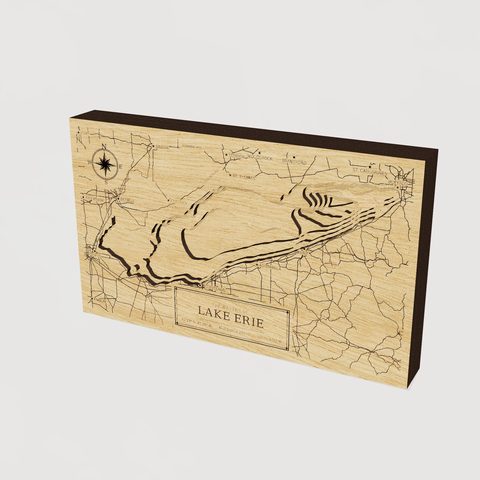 Lake ErieOH · PA · NY · MI · ON · 3D wood depth map · from $149
Choosing a size and a personal line
Size matters more with a long or complicated lake. A narrow lake that stretches miles reads well at 24 or 30 inches, where the bays and points keep their character. A compact lake like Edinboro looks right at 12 or 17 inches, since there is less shoreline to fit. Prices run $149 for 12 inches, $249 for 17, $399 for 24 and $599 for 30, with free shipping in the lower 48.
At checkout you can add a family or cabin name line, a short message, and a star on any spot on the shore. The star is the part people remember. Put it on the dock, the point where you learned to swim, or the cove where someone proposed. A short message works best when it states a fact rather than a sentiment: a year, a lake name, the name of a place. "Since 1962" says more than a paragraph would.
We make each map to order in Waterford, Pennsylvania, and it ships in about seven to ten days. Any of the 104,419 US lakes can be made on request, so if yours is not among the lakes we list, you can search for it or commission it. You can also browse all the lakes we map, or read more in our other guides.


